
Geologic History of Dinosaur Ridge
From Red Rocks to Dinosaur Ridge
In 2014, while studying photography and volunteering at Dinosaur Ridge, I put together a semester project on the geology behind what I was photographing. Recently I found that project again.
Some of it still works. Some of it needs correcting. But the central idea has only become more interesting to me.
You can walk through deep time here.
That isn’t merely poetic license. The National Park Service describes the Morrison-Golden fossil area as a place where tilted rocks allow us to cross many tens of millions of years of geologic history in a surprisingly short walk. Its fossil sites preserve chapters from the Late Jurassic through the end of the Cretaceous.
But our walk can begin even earlier.
When I gave presentations at Dinosaur Ridge, I often started by asking people to look west toward Mount Morrison and the ancient rocks of the Front Range.
Look west.
Then I brought them back to where they were standing.
Look down.
The rocks beneath their feet represented an entirely different time.
Then look east.
Those tilted layers do not stop at the Hogback. They descend beneath the Denver Basin. The Colorado Geological Survey reports that the top of the Niobrara Formation reaches approximately 8,000 feet beneath the surface in Denver and Lakewood.
So let’s take a walk. Not simply from west to east.
Let’s walk through time.
First Stop: A Missing Chapter
Before dinosaurs, before the Western Interior Seaway, and long before there was a Dinosaur Ridge, the foundation of this landscape was already ancient.
Near the upper part of Red Rocks Park, much younger sedimentary rocks rest against Precambrian basement rock. The old basement in this part of the Front Range is on the order of 1.7 billion years old. Resting against it are rocks made from sediment shed from much younger ancestral mountains.
The contact is an unconformity: a break in the rock record representing an enormous span of missing time.
The first thing we encounter on our walk through time is time that isn’t there.
Red Rocks: The Fountain Formation
The great red walls and monoliths of Red Rocks are made largely of the Fountain Formation: coarse sandstone and conglomerate derived from erosion of the Ancestral Rocky Mountains. Streams carried gravel, sand and mud out of those mountains and spread the sediment along their flanks.
The modern Rockies were not there yet. Neither was the Red Rocks landscape we know today. We are looking at the hardened remains of an older mountain system and the sediment it left behind.
As we continue east through the tilted sequence, the rocks become younger. The walk is beginning.
Permian Red Rocks – and a Question I Still Have
Younger red beds take us into the Permian. The Lyons Sandstone records a very different Colorado, including wind-blown sand and other sedimentary environments.
Some unusual crinkled, banded structures I have photographed in these rocks around Red Rocks earned an unofficial name in my field notes: the “Bacon Formation.” That is not a formal geologic formation, and I am not claiming a biological origin for the structures. It is simply my name for a feature that made me stop, look closer, photograph it, and ask what I was seeing.
That question is still open. Which is one reason I am returning to this material now.
252 Million Years Ago: The Great Dying
Continue forward in time and we cross one of the largest biological catastrophes known in Earth’s history: the end-Permian mass extinction, about 252 million years ago.
More than dinosaurs separate us from that world. Entire ecosystems disappeared. The rocks continue into the Triassic, but life on Earth had been profoundly reorganized.
A walk through deep time is not a smooth march of progress. Sometimes the trail crosses an absence.
Triassic to Jurassic
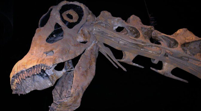
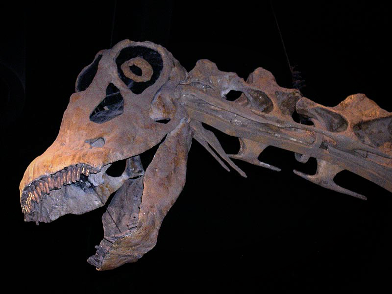
Triassic and Jurassic rocks carry us toward the age most visitors have been waiting for. By the Late Jurassic, rivers, floodplains, lakes and wetlands spread sediment across this region. Those deposits became the Morrison Formation.
Now the dinosaurs arrive in force: immense sauropods, stegosaurus, meat-eating theropods like Allosaurus and many smaller animals shared a landscape of conifers, ginkgoes, ferns and other plants.
And here our walk reaches Quarry Five.
Quarry Five: Listen for the Dinosaurs
One of my favorite tools for giving tours at Dinosaur Ridge was a working Geiger counter. There was only one that worked, as I remember, and it tended to get snatched up quickly by the docent volunteers, so you learned to arrive early.
One day I was explaining to a mother how we could use it to help locate dinosaur bones still embedded in the rock at Quarry Five. I looked down at her four-year-old and said, “I’ll bet your four-year-old could do that.”
So I handed him the Geiger counter.
He immediately put it in his mouth.
Okay. Perhaps a little more instruction was required.
But after that, he could do it.
Instead of pointing to a spot on the wall and telling a child, “There’s dinosaur bone,” we could let him move the detector across the rock and listen. Background clicks here. More activity there. Follow the sound.
Now he wasn’t simply being shown a dinosaur bone.
He was finding one.
The larger bones were relatively easy to recognize once you knew what you were looking for. The harder game was finding the little things. Crocodile teeth were there too, tucked into the rock and easy to overlook. Once someone showed you how to see them, suddenly the wall contained more than ‘dem dinosaur bones.
The fossil bone at this locality is radioactive because uranium-bearing minerals entered the bone during fossilization and later alteration. My old 2014 notes record one bone at 422 counts per minute against a background reading of 140.
Science doesn’t always begin with knowing what you’re doing.
Sometimes it begins by figuring out which end of the Geiger counter doesn’t go in your mouth.
Keep Walking: Into the Cretaceous
The Jurassic does not last forever. Continue east through the tilted beds and the rocks take us into the Cretaceous.
Around 100 million years ago, a vast shallow sea was advancing across the interior of North America. The Rocky Mountains as we know them did not yet exist, and much of the continent lay at lower elevation.
Along the margin of that sea, sandy coastal environments became part of what we now call the Dakota Group. Dinosaurs walked across those surfaces and left something different from bones.
They left behavior.
A bone tells us an animal was there. A footprint catches it doing something.
The famous east-side Dinosaur Ridge track beds preserve that moment: animals moving across a Cretaceous landscape along what has sometimes been called a dinosaur freeway.
Then Came the Sea
Walk farther into the Cretaceous sequence and the shoreline gives way to marine rocks. Mud, lime and organic material accumulated as the Western Interior Seaway advanced and retreated across Colorado.
The Benton and younger marine units record that changing sea. Later came the Niobrara Formation, including limestone and chalky shale, followed by the great thickness of Pierre Shale.
This is where the modern landscape can fool us. Today these rocks stand tilted near the Front Range, but the layers continue eastward beneath younger sediments of the Denver Basin.
The top of the Niobrara reaches approximately 8,000 feet beneath Denver and Lakewood – more than a mile and a half below the modern city.
The page we can touch at the mountain front continues beneath a landscape occupied by millions of people.
Somebody Turned the Pages Upright
These sedimentary layers were originally deposited much closer to horizontal. Near the end of the Cretaceous and into the early Cenozoic, the Laramide mountain-building episode uplifted the Rocky Mountain region and folded, faulted and tilted the rocks along the Front Range.
That is why this walk works.
Erosion cut across the upturned layers and exposed their edges. Instead of drilling downward through the entire stack, we can move across the landscape and cross from older rocks into younger ones.
Somebody turned the pages upright, and erosion opened the book.
The Golden Fault
The story is not only deposition and uplift. Faulting helped shape the eastern edge of the Front Range as well. My original 2014 project included the Golden Fault, a complex reverse-fault zone along the mountain front near Golden.
The details deserve a modern re-check before I repeat every measurement from my old bibliography, but the larger lesson remains useful: the rocks here were not simply deposited and politely tilted. They were fractured, displaced, uplifted and eroded.
The Ridge Is Still Being Made
My old project called weathering the “geologic forces that created Dinosaur Ridge.” I would phrase that differently now.
Weathering and erosion are exposing Dinosaur Ridge – and dismantling it at the same time.
Water enters cracks and freezes. Roots enlarge fractures. Minerals dissolve. Softer layers weather faster than resistant sandstone. Gravity collects broken rock as talus. These processes reveal the pages we are reading while slowly destroying the same exposures.
Without erosion, much of the story would remain buried. Because of erosion, none of it will remain exposed forever.
Toward the End of the Dinosaurs
Continue eastward and forward through time and eventually the Cretaceous approaches its end, about 66 million years ago. The non-avian dinosaurs disappear at the Cretaceous-Paleogene boundary.
But dinosaurs did not vanish completely.
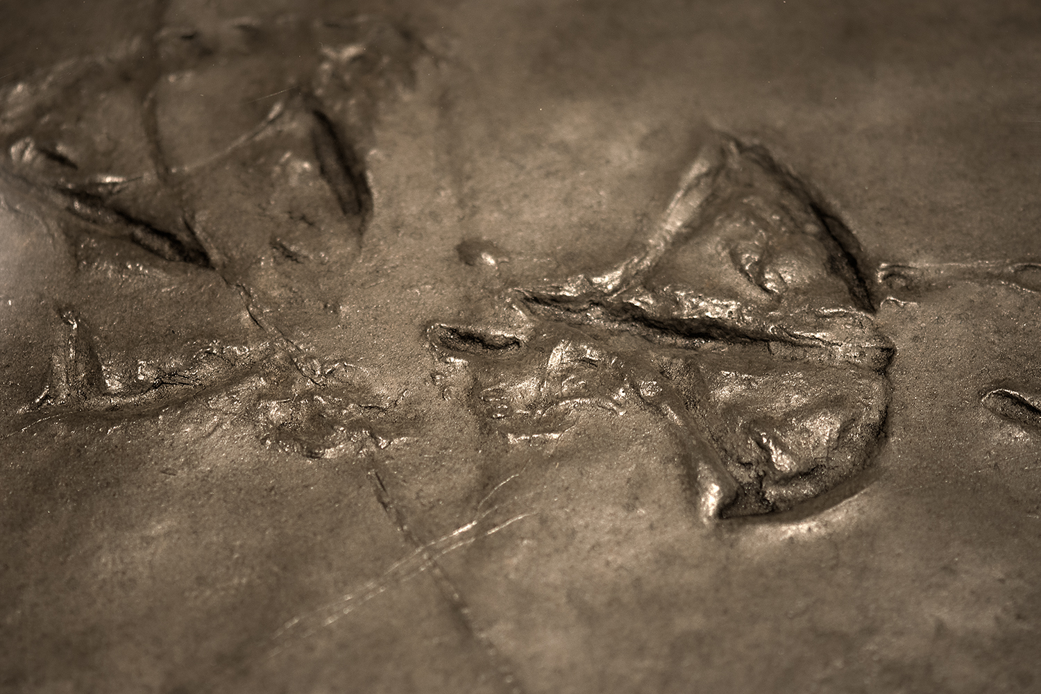
These fossil tracks preserve the passage of a web-footed bird across soft sediment during the Eocene Epoch, roughly 50 million years ago. By then, the non-avian dinosaurs had been gone for millions of years—but their avian descendants were very much alive.
The dinosaurs didn’t entirely disappear. Some of them left footprints like these.
Birds are dinosaurs.
That makes the chicken scratching around a modern yard part of the same enormous story – not a visitor from outside it, but one surviving branch of the dinosaur family tree.
Why I Came Back to This
This began as a photography semester project in 2014. Finding it again twelve years later has been a useful reminder that science is not weakened when we return to old ideas and correct them. That is part of the process.
Some of my old wording was wrong. Some sources have aged badly. Some observations still make me smile. And some questions I had then are questions I still want to pursue.
That is especially appropriate now, as I find myself re-entering the science zone, the Dino zone – and, apparently, the Great Dying zone.
Looking is not the same thing as seeing.
In 2014 I photographed Dinosaur Ridge because I wanted to understand what I was looking at.
I still do.
The difference is that today I’m a little more comfortable saying:
I don’t know. Let’s look closer.
That’s where science begins.
And, for me, that’s also where art begins.
So the next time you’re at Red Rocks or Dinosaur Ridge, don’t just look outward at the scenery.
Look down.
You’re standing on time.
Then start walking.
Stay curious.
Source Notes
This revision began with my 2014 Dinosaur Ridge semester project and preserves several firsthand tour memories and observations from that document. Geological facts have been updated or softened where the old project overreached.
National Park Service, “Paleontology of Morrison-Golden Fossil Areas National Natural Landmark” (2025).
National Park Service, “The Morrison Formation” (updated 2026).
Colorado Geological Survey, RockTalk V13N1, “Niobrara Formation Depth and Temperature in the Denver Basin.”
Dinosaur Ridge educational materials and Martin G. Lockley Discovery Center information, including Quarry Five/Bone Bed.